
Kharantsy, Lake Baikal, Siberia
Lake Baikal is a rift lake, situated in the south of the region of Siberia, between the Republic of Buryatiya to the southeast and the Irkutsk Oblast to the northwest.
Home  > WATER SPORTS  > Scuba Diving  > Wallaroo Jetty, Yorke Peninsula
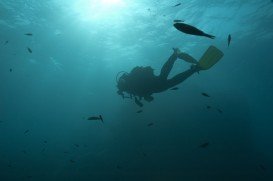
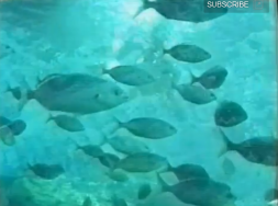
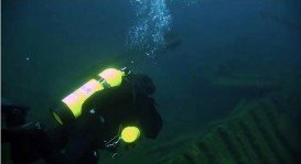
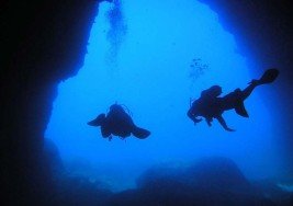
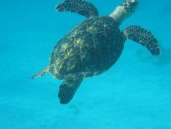
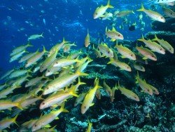
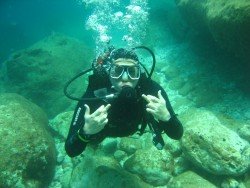
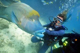
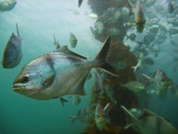
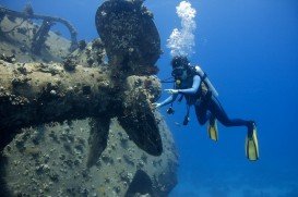
The Wallaroo Jetty is an incredible 869 m / 2851 ft long. It became part of the Bulk Handling facility in 1958 and was opened to anglers in 1971. Wallaroo Jetty is also a favorite scuba diving destination, with tank refills and accessories available in the town. Large numbers of fish will welcome you as you glide between the jetty’s pylons, which are encrusted with many different forms of marine life, like Whiting fishes, snappers, squids, flat-heads, Tommy Ruffs, garfishes, salmons, mullets, crabs and prawns to mention a few.
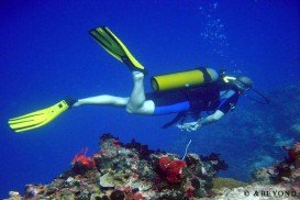
The bottom can be a very silty, so take care not to stir it up. Enter via the swimming pool, to the right of the jetty. Take care not to get entangled in the many fishing lines and descend between the pylons. The spot is recommended for practitioners of all level of difficulty while its maximum depth drops at 14 m/45 ft.
The National Trust Wallaroo Heritage and Nautical Museum is located on Jetty Rd and is worth a look to gain an understanding of the town’s maritime history. Jubilee Square is a perfect picnic spot with electric BBQ facilities and a children’s playground. Numerous accommodation options and leisure activities are offered to the visitors of the spot.
Lake Baikal is a rift lake, situated in the south of the region of Siberia, between the Republic of Buryatiya to the southeast and the Irkutsk Oblast to the northwest.
Victoria is the second-smallest state of Australia. It borders with New South Wales to the north and Tasman Sea to the east. The unique combination of spectacular coastline, pristine beaches, numerous national parks, dense forests and mountains attract visitors all year long and offer a plethora of activities to sport lovers.
The Virgin Islands of the United States, or the U.S. Virgin Islands lie in the Caribbean Sea, east of Puerto Rico. This group of islands consist of the main islands of Saint Thomas, which is home to the capital city of the U.S. Virgin Islands, Saint John, Saint Croix, Water Island and other surrounding minor islands.The climate here is classified as tropical savanna climate, mostly affected by moderate trade winds.
False Bay is a body of water characterized by Cape Hangklip and Cape Peninsula, located in the southwest of South Africa. The bay is 30 km/18.7 mi wide, offering a Mediterranean climate with warm, dry summers and wet damp winters. The east and western shores of the bay are rocky and mountainous with visible peaks rising from the waters, while the northern side comprises a long, curving beach.
Kailua Kona is located in the North Kona District, Hawaii. It is a lively seaside town with sunny tropical weather all year long and lies at the bottom of the Hualalai Volcano.
Famous due to its proximity with tropical islands, lush forests and Mount Kinabalu, Kota Kinabalu is the capital of the state of Sabah located in Borneo. It is located on the west coast of Sabah within the West coast Division. Formerly known as Jesselton, it enjoys a tropical rainforest climate and lies by the coast, overlooking the South China Sea and bordered by the Crocker range which is home to Mount Kinabalu.
Adelaide, the liveliest city in Australia, is the capital of South Australia state. The city is situated on the Adelaide Plains and more specifically at the north side of Fleurieu Peninsula. The city is built next to Torrens River and is surrounded by the Mount Lofty Ranges and the Gulf St Vincent.
Whyalla is located on the western shore of upper Spencer Gulf, at 394 km/244 mi in the northwest of Adelaide, in South Australia. Dolphins and bird-life often frequent the waters, while the rocky coastline is a popular destination for scuba diving.
Adelaide, the liveliest city in Australia, is the capital of South Australia state. The city is situated on the Adelaide Plains and more specifically at the north side of Fleurieu Peninsula. It is built next to Torrens River and is surrounded by the Mount Lofty Ranges and the Gulf St Vincent.
Adelaide, the liveliest city in Australia, is the capital of South Australia state and is situated on the Adelaide Plains and more specifically at the north side of Fleurieu Peninsula. The city is built next to Torrens River and is surrounded by the Mount Lofty Ranges and the Gulf St Vincent.
Adelaide, the liveliest city in Australia, is the capital of South Australia state and is situated on the Adelaide Plains and more specifically at the north side of Fleurieu Peninsula. Semaphore is a north-western seaside suburb of Adelaide of the LeFevre Peninsula, at 14 km / 8.4 mi from the CBD, in the Australian state of South Australia, and is part of the City of Port Adelaide Enfield.
Adelaide, the liveliest city in Australia, is the capital of South Australia state. The city is situated on the Adelaide Plains and more specifically at the north side of Fleurieu Peninsula. Marino is a suburb in the south of Adelaide, sitting on coastal hills and overlooking at Gulf St Vincent. It neighbours with Seacliff, Hallett Cove and Kingston Park.
Adelaide, the liveliest city in Australia, is the capital of South Australia state. The city is situated on the Adelaide Plains and more specifically at the north side of Fleurieu Peninsula. The city is built next to Torrens River and is surrounded by the Mount Lofty Ranges and the Gulf St Vincent.
Adelaide, the liveliest city in Australia, is the capital of South Australia state. It is situated on the Adelaide Plains and more specifically at the north side of Fleurieu Peninsula.The city is built next to Torrens River and is surrounded by the Mount Lofty Ranges and the Gulf St Vincent.