
Woodbuck Basin Trailhead, Angels Camp
Bear Valley is a ski area located near Angels Camp, on highway 4, between Lake Tahoe and Yosemite, approximately 3 hours southeast of Sacramento, California, USA.
Home > MOUNTAIN SPORTS > Backpacking / Trekking > Eagle Meadow, Sonora
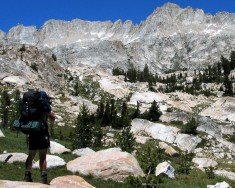
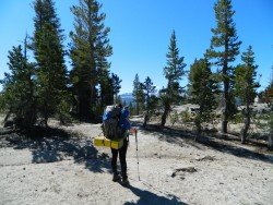
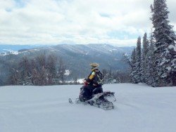
Trails are spread everywhere across the mountains. There is something for everyone in the Sonora Pass region, as there are all kind of trails, easy, intermediate and high elevation and also long day adventures. Eagle Meadow is located east of Highway 108, approximately half an hour away.
There are three easy, natural, wonder trails, perfect for backpacking. The first one is Columns of the Giants. It is a one way, quarter mile (0.25 mi/0.40 km) trail located next to the Pigeon Flat Campground, where you can camp and which is approximately 1.5 mi/2.4 km east of Dardanelles Resort.
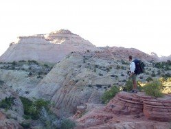
It is an easy trail, that takes you to an unusual geologic formation with magnificent views of basalt columns, reminding of the Devil’s Postpile. The second one is Trail of the Gargoyles. It is a 1.5 mi/2.4 km, one way trail, taking you to some strangely shaped, volcanic, rock formations, called Trail of the Gargoyles.
To reach this trail, drive east from Strawberry to the Herring Creek Road turnoff, on the right. When reaching the overlook up the trail, you get a spectacular view of a canyon and mountains. The third trail is the Trail of the Ancient Dwarfs.
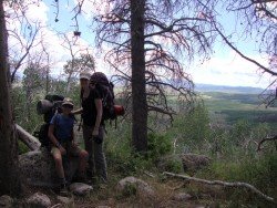
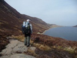
It is a one way, 5 mi/8 km hike, leading you through a forest of ancient dwarf trees. A visit to this trail is best combined with a view of the ancient Bennett Jupiter, because they are both near Eagle Meadow.
Bear Valley is a ski area located near Angels Camp, on highway 4, between Lake Tahoe and Yosemite, approximately 3 hours southeast of Sacramento, California, USA.
Queenstown is considered by many sportsmen as the capital of extreme sports and adventure activities. It is situated in Otago region, in the South Island, New Zealand.
Arrowtown is a small, former gold-mining town, situated in Otago region, in the South Island, New Zealand. It is only 20 min drive from Queenstown (connected through Shotover Gorge) and lies on the banks of Arrow River, one of the richest sources of gold in the 1860's.
Located almost at 150 km/93 mi from Nairobi City, Mt. Kenya is located just south of the equator, offering three climbing routes, namely Naro-Moru, Sirimon and Chogoria. Mt. Kenya has magnificent cliffs and glaciers that protect the highest peaks. Highest peaks here are Batian at 5199 m/17057 ft, Nelion at 5188 m/17021 ft and Point Lenana at 4985 m/16355 ft.
Wanaka is a small town in Central Otago in the South Island of New Zealand, situated on the south side of Lake Wanaka.
The plateau of Folois nestles at the southwest foot of Mount Erymanthus, in Hleia. Its name derived from mythology and the king of the Centaurs, Follo, friend of Hercules. Folois forest, with the unrivaled natural beauty, is one of the largest oak forests in Europe.
Bear Valley is a ski area located near Angels Camp, on highway 4 between Lake Tahoe and Yosemite approximately 3 hours southeast of Sacramento, California, USA.
Bear Valley is a ski area located near Angels Camp, on highway 4, between Lake Tahoe and Yosemite, approximately 3 hours southeast of Sacramento, California, USA.
Kirkwood Mountain Resort is a year round resort in Kirkwood, south of Lake Tahoe, in El Dorado County, California, USA. Kirkwood is at 33 mi/53.1 km south of South Lake Tahoe, on State Route 88 and it is surrounded by El Dorado National Forest.
Sonora Pass is located near Pinecrest, Tuolumne County, California, USA. It is off of Highway about 60 mi/96.5 km east of Sonora.
Mammoth Lakes is located near Mammoth Mountain, in California’s eastern Sierra about 100 mi/161 km south of Nevada State Line, 9 mi/14.5 km northwest of Mount Morrison, at an elevation of 7880 ft/2402 m, Mono County, California, USA.
Mount Shasta is located in northern California, east of Interstate 5 along SR89, between Mount Shasta city and McCloud city, California, USA.
Sonora Pass is located near Pinecrest, Tuolumne County, California, USA. It is off of Highway about 60 mi/96.5 km east of Sonora.
Soda Springs ski resort is located near Soda Springs, Nevada County, California, USA. Soda Springs ski resort is just off of Highway 80, near the Donner Summit.