

ADD COMMENT
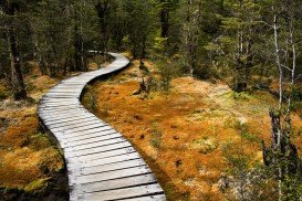
Milford Track, Te Anau
/
Southland New Zealand
Te Anau is a small town, situated in Fiordland region, in the South Island of New Zealand.
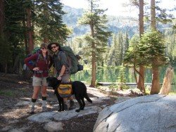
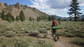
Trails are spread everywhere across the mountains. There is something for everyone in the Sonora Pass region, as there are all kind of trails, easy, intermediate and high elevation and also long day adventures. One of the best trails to go backpacking is Kennedy Meadows to Relief Reservoir.
It is a one way, 3 mi/4.8 km, moderate trail with elevation gain of 1000 ft/304.8 m. This trail takes you to the shores of Relief Reservoir. Begin your adventure at Kennedy Meadow. The first mile is an easy stroll, going through the meadow, where some episodes of “Little House on the Prairie”, a television creation by Michael Landon, were filmed.
After crossing a bridge, you begin a steep climb on a wide trail, carved out of the mountainside, right after the Relief Dam was being constructed in the early 1900’s. There is another bridge and steep climb, taking you past an old P G and E building. Not far away you find the area around the dam.
While continuing on the trail along the hillside high above the reservoir, you turn onto a use trail that leads to the dam. You can camp near the Lake or the Meadow.
Te Anau is a small town, situated in Fiordland region, in the South Island of New Zealand.
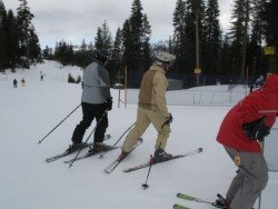
Bear Valley is a ski area located near Angels Camp, on highway 4, between Lake Tahoe and Yosemite, approximately 3 hours southeast of Sacramento, California, USA.
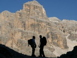
The Dolomite area offers a wide variety of trekking itineraries with different levels of difficulty for the sport's fans. With countless paths and routes in a breathtaking landscape, the entire area seems to be the ideal destination for hiking on the mountains! The choices are endless in the Dolomite's open playground arena such as Arabba, Creppe Rossa, Selva di Cadore, Sasso Bianco, Val Civetta, Croda da Lago, Val di Fassa.
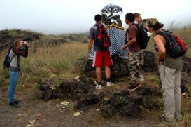
Bali is a province in Indonesia with a few neighboring islands including the Isle of Bali. The island of Bali lies at about 8 degrees/ 0.13 radians on the south of equator and at 3.2 km/1.9 mi from Java. It is surrounded by coral reefs with white sand beaches on the south and black sand beaches on the north and the west of the island.
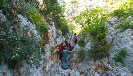
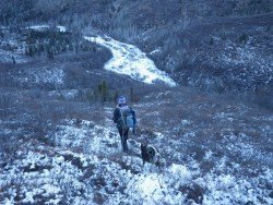
Leonidio, situated on the east coast of Peloponnese, combines surprisingly elements of mountain with sea. Adjacent in the Myrtoon Sea and settled in the highlands of Parnon Mountain range, the region is famous for its remarkable scenery, perfect for trekking activities.
Sonora Pass is located near Pinecrest, Tuolumne County, California, USA. It is off of Highway about 60 mi/96.5 km east of Sonora.
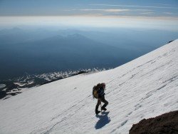
Mount Shasta is located in northern California, east of Interstate 5 along SR89, between Mount Shasta city and McCloud city, California, USA.
Sonora Pass is located near Pinecrest, Tuolumne County, California, USA. It is off of Highway about 60 mi/96.5 km east of Sonora.
Sugar Bowl ski resort is a ski area in northern Placer County, near Norden, along Donner Pass of Sierra Nevada, at about 46 miles/74 km from Reno on Interstate 80, California, USA. The resort was opened on the 15th of December 1939.

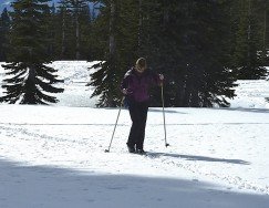
Mammoth Lakes is located near Mammoth Mountain, in California’s eastern Sierra about 100 mi/161 km south of Nevada State Line, 9 mi/14.5 km northwest of Mount Morrison, at an elevation of 7880 ft/2402 m, Mono County, California, USA.
Mount Shasta is located in northern California, east of Interstate 5 along SR89, between Mount Shasta city and McCloud city, California, USA.
Mount Shasta is located in northern California, east of Interstate 5 along SR89, between Mount Shasta city and McCloud city, California, USA.
Bear Valley is a ski area located near Angels Camp, on highway 4, between Lake Tahoe and Yosemite, approximately 3 hours southeast of Sacramento, California, USA.
Northstar California is a ski resort, located near Truckee, California, USA. It is a very big ski resort, covering 3170 skiable acres/12.83 km².


