ADD COMMENT
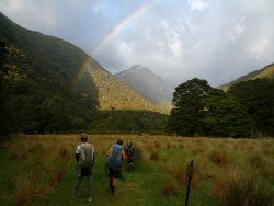
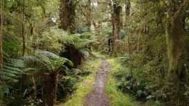
Kepler Track, Te Anau
/
Southland New Zealand
Te Anau is a small town, situated in Fiordland region, in the South Island of New Zealand.
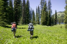
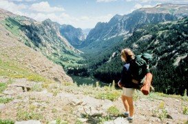
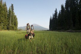
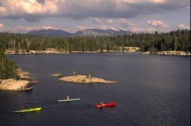
Trails are spread everywhere across the mountains. There is something for everyone in the Sonora Pass region, as there are all kind of trails, easy, intermediate and high elevation and also long day adventures. One of the best trails to go backpacking is Burst Rock to Powell Lake. It is a one way, 2 mi/3.2 km, moderate trail with elevation gain of 500 ft/152.4 m.
During the Gold Rush years, the Burst Rock trail was used as the route of the old emigrant trail. Nowadays the trail takes you on that route. When reaching the summit of Burst Rock, you get a breathtaking view down the Stanislaus River canyon towards Pinecrest. In the meadow you can see remnants of the old cabin.
The trail leaves from the parking lot and goes across the contour of the ridge, offering a wonderful view of Burst Rock and then leads up to the summit. It’s just above a mile to the top of Burst Rock at 9100 ft/2774 m elevation. If you want more adventure, keep going on the trail down the back side of Burst Rock.
In less than a mile, turn left and discover Powell Lake, which is a popular camping and swimming spot.
Te Anau is a small town, situated in Fiordland region, in the South Island of New Zealand.
Te Anau is a small town, situated in Fiordland region, in the South Island of New Zealand.
Mount Shasta is located in northern California, east of Interstate 5 along SR89, between Mount Shasta city and McCloud city, California, USA.
Bear Valley is a ski area located near Angels Camp, on highway 4, between Lake Tahoe and Yosemite, approximately 3 hours southeast of Sacramento, California, USA.
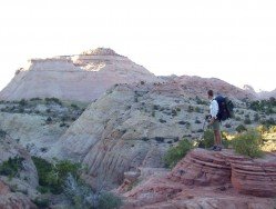
Sonora Pass is located near Pinecrest, Tuolumne County, California, USA. It is off of Highway about 60 mi/96.5 km east of Sonora.
Mount Shasta is located in northern California, east of Interstate 5 along SR89, between Mount Shasta city and McCloud city, California, USA.
Dodge Ridge ski resort is located near Pinecrest, Tuolumne County, California, USA. It is off of Highway 108.3 mi/174.3 km east of Sonora.
Bear Valley is a ski area located near Angels Camp, on highway 4, between Lake Tahoe and Yosemite, approximately 3 hours southeast of Sacramento, California, USA.
Mount Shasta is located in northern California, east of Interstate 5 along SR89, between Mount Shasta city and McCloud city, California, USA.
Bear Valley is a ski area located near Angels Camp, on highway 4, between Lake Tahoe and Yosemite, approximately 3 hours southeast of Sacramento, California, USA.
Squaw Valley Ski Resort is located in Olympic Valley, California, USA. It is one of the largest ski areas in the US after Heavenly and was the site of the 1960 Winter Olympics.
Dodge Ridge ski resort is located near Pinecrest, Tuolumne County, California, USA. It is off of Highway about 50 mi/80.5 km east of Sonora.
Sonora Pass is located near Pinecrest, Tuolumne County, California, USA. It is off of Highway about 60 mi/96.5 km east of Sonora.
Sonora Pass is located near Pinecrest, Tuolumne County, California, USA. It is off of Highway about 60 mi/96.5 km east of Sonora.