Yosemite National Park
Yosemite National Park is located near Mariposa, California, USA.
Home  > OTHER SPORTS  > Bicycling / Cycling  > Pickel Meadow, Sonora
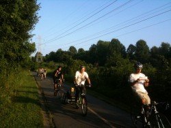
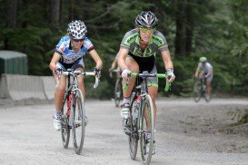
One popular sport at Pinecrest Lake is bicycling. In summer there is a little shopping area, available for bicycle rentals. If you want to do casual bicycling, the community of Pinecrest makes a perfect place to explore. Traffic is light and hills are few, making it an easy going ride.
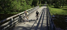
You can also wander around campgrounds and enjoy the paved walking-bicycle trail, that runs from Pinecrest Campground through Meadowview Campground. One favorite trail for bicycling is Pickel Meadow to Sonora Junction. It is an easy 5 mi/8 km road, that starts at a small turnout on Highway 108, on the east side of Sonora Pass, at the west end of Pickel Meadow.
Ride east on Highway 108 and pass the Marine Mountain Warfare Training center. At your right you find the expanse of Pickel Meadow. Snow-clad Tower Peak can be seen in the distance. This trail drops down to a bridge just across the river and then climbs up gently to Sonora Junction. Highway 108 ends there as it joins Highway 395. You can continue your ride on Highway 395, but pay attention due to more traffic.
Yosemite National Park is located near Mariposa, California, USA.
Havre aux Maisons Island is located in the House Harbor Island (French "Ile du Havre aux Maisons") in Quebec, Canada. Between Grindstone and House Harbor Island, the harbor was already known as Harbor Maison. The airport of Magdalen Islands is located in Havre aux Maisons.
Christchurch is situated in Canterbury region of the South Island and is the second largest city of New Zealand. It represents the getaway to Antarctica, while lying next to Pegasus Bay and the Pacific Ocean.
Sonora Pass is located near Pinecrest, Tuolumne County, California, USA. It is off of Highway about 60 mi/96.5 km east of Sonora.
Bear Valley is a ski area located near Angels Camp, on highway 4, between Lake Tahoe and Yosemite, approximately 3 hours southeast of Sacramento, California, USA.
Mount Baldy is located in San Bernardino County, on Mount San Antonio (aka Mount Baldy), California, USA. The city is located only 45 mi/72.4 km from Los Angeles.
Bear Valley is a ski area located near Angels Camp, on highway 4, between Lake Tahoe and Yosemite, approximately 3 hours southeast of Sacramento, California, USA.
Sonora Pass is located near Pinecrest, Tuolumne County, California, USA. It is off of Highway about 60 mi/96.5 km east of Sonora.
Bear Valley is a ski area located near Angels Camp, on highway 4, between Lake Tahoe and Yosemite, approximately 3 hrs southeast of Sacramento, California, USA.
Mount Shasta is located in northern California, east of Interstate 5 along SR89, between Mount Shasta city and McCloud city, California, USA.
Sonora Pass is located near Pinecrest, Tuolumne County, California, USA. It is off of Highway about 60 mi/96.5 km east of Sonora.
Bear Valley is a ski area located near Angels Camp, on highway 4, between Lake Tahoe and Yosemite, approximately 3 hrs southeast of Sacramento, California, USA.
Sierra at Tahoe is a ski resort located near Twin Bridges on Hucklberry Mountain, south of Lake Tahoe, California, USA.